CITY OF ATHENS
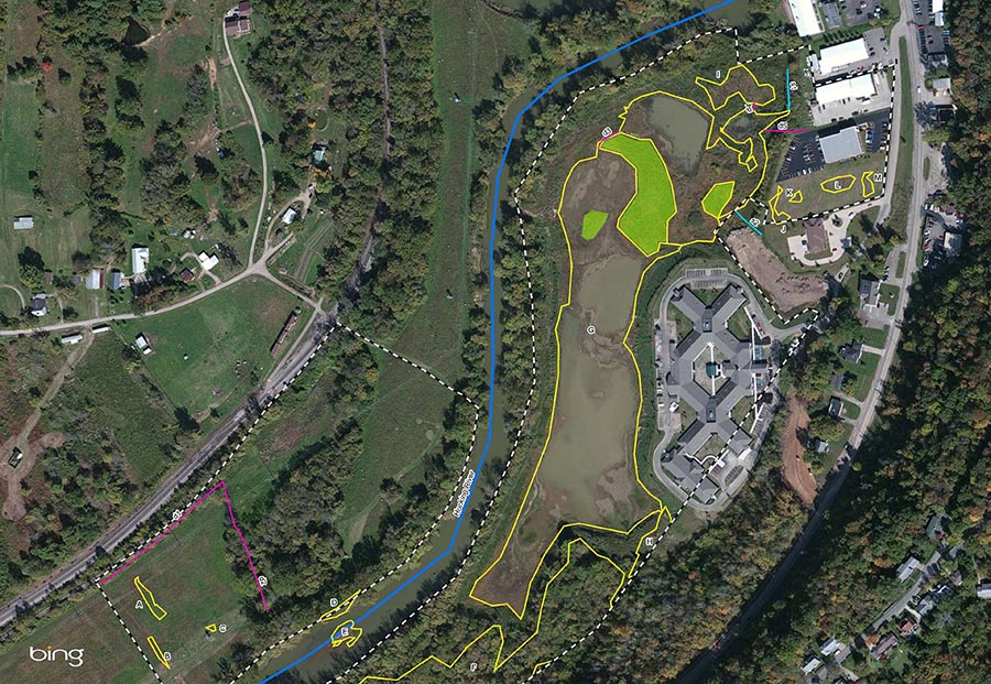
L&A completed a jurisdictional waters and isolated wetland delineation for the proposed Columbus Road Bike Path Spur in Athens, Ohio. The project involves the extension of the existing bike path to provide a connection from the Hockhocking-Adena Bikeway to Columbus Road. The bike path is being constructed with grant funding from the Ohio Department of Transportation (ODOT) Transportation Alternative Program and the Clean Ohio Trails Fund.The scope of our services included a review of literature and mapping to gather information regarding any known resources at the site. As part of the desktop evaluation, L&A reviewed the following resources: National Wetland Inventory (NWI) maps, soils maps, National Hydrography Dataset (NHD), Flood Information Rate Maps (FIRM), topographic maps, and aerial photography. Following the desktop review, a routine wetland delineation using the U.S. Army Corps of Engineers’ 1987 Manual for Wetland Delineation and Eastern Mountain and Piedmont Regional supplement was completed. During the site visit, L&A identified all wetlands, streams, and ditches within the study area and assessed their quality. Wetlands were evaluated using the Ohio Rapid Assessment Method (ORAM) and streams were assessed using Ohio’s Field Evaluation Manual for Headwater Streams. L&A identified thirteen wetlands, two streams, and five ditches in the project area. These resources were logged in the field using a GPS unit and the boundaries of wetlands were clearly identified with flagging tape. A report of findings was prepared for inclusion in USACE permit applications.